PLANNING
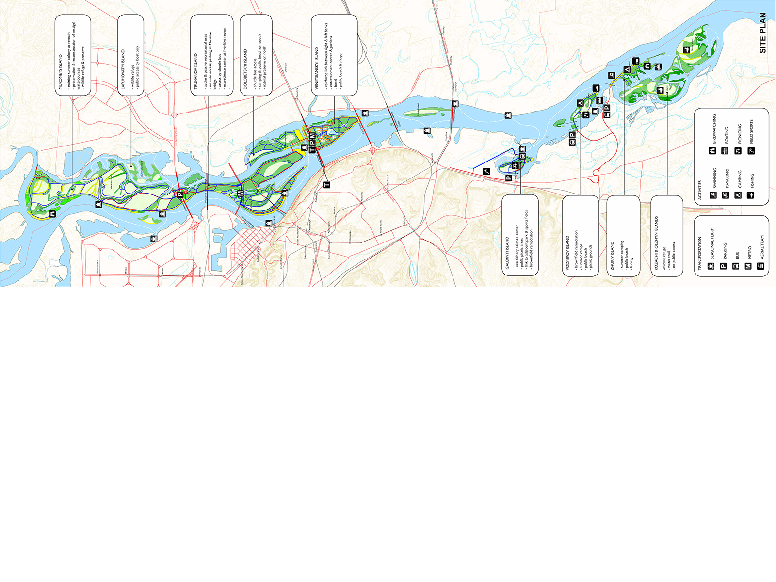
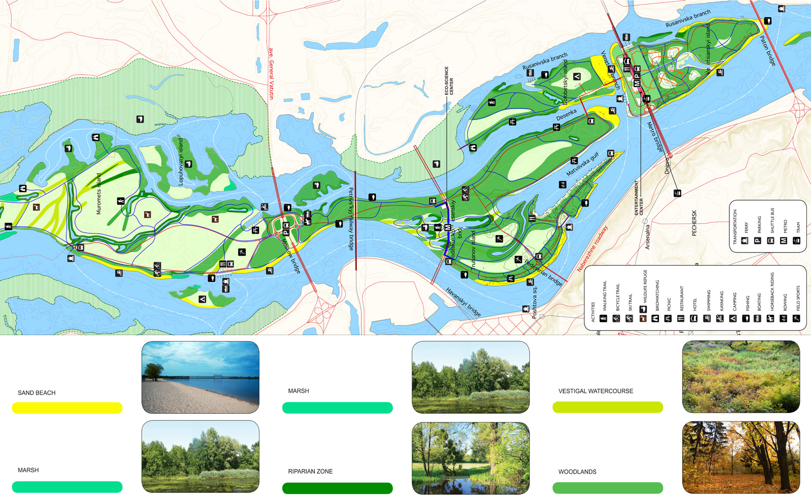
Most of the natural areas are located on the islands furthest to the north and south. These areas are designated as refuges, with very little or no human activity permitted. Pathways allow visitors to experience true wilderness in the middle of the city, with visits limited to daytime only.
Adjacent to the city core and in the newly developing residential areas to the south are zones of "reconstructed nature" with medium-intensity use. Both active and passive activities are encouraged, and rustic accommodation for temporary stays are provided. Science centers are set up for educational purposes. Public transportation gives direct access to the mainland.
The central area is a key element in our proposal. The Dnieper divides the city into two distinct halves - the right bank, magnificently sited on a bluff, is home to the historic core with its monasteries, civic buildings, and commercial and mixed uses; the left bank is a flatland filled with vast, disconnected residential districts. We propose using the central island to create a link between these two halves in order to knit the city together into a more coherent entity. This island will become the new center of the city and will be dedicated to recreational uses that are harmonious with the rest of the park.
GREEN NETWORK
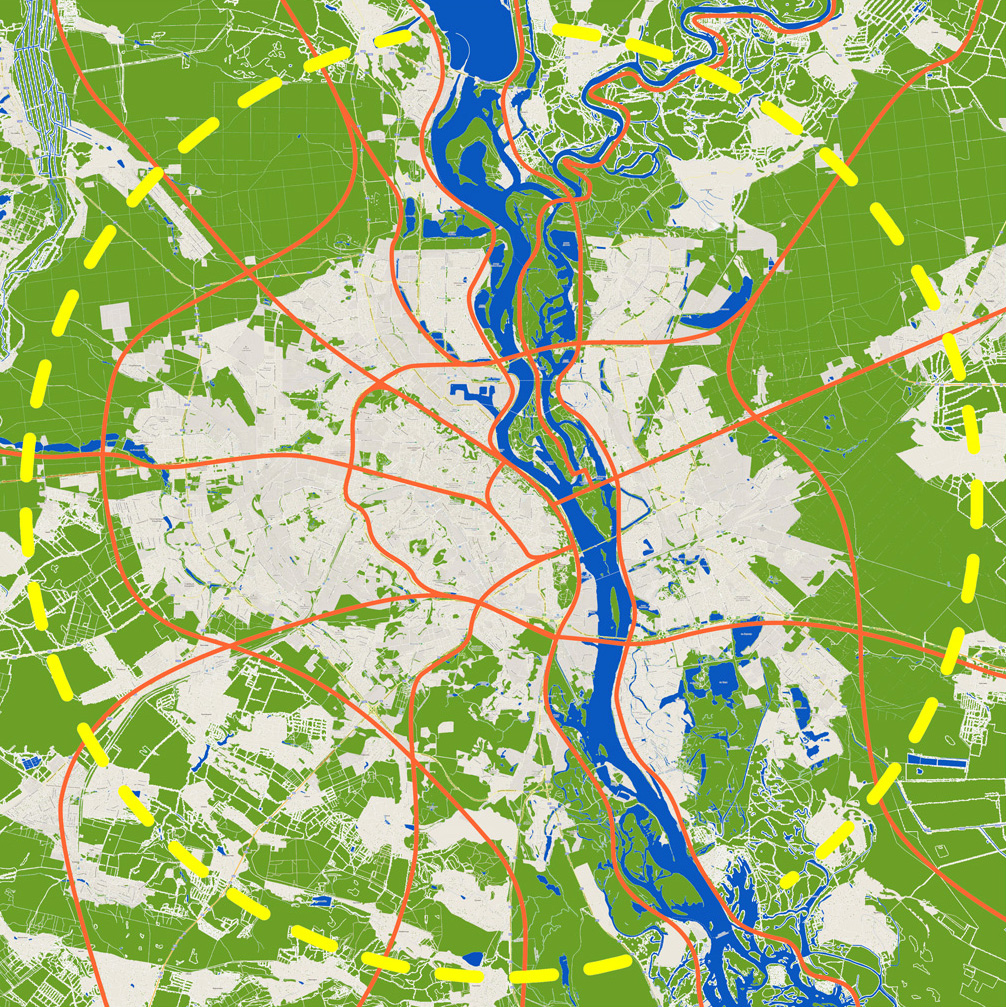
Natural ecologies do not recognize legal boundaries, and Kyiv Islands Park is thought of as part of a larger green network that extends beyond the city limits. While the existing links within this network should be carefully maintained, new links can be developed using the underutilized road and rail rights of way. This network can serve many purposes - wildlife corridors to help sustain animal populations; continuous green space to allow a wide variety of flora to thrive; a region-wide network of bicycle and ski paths to promote recreational use and a healthy lifestyle. This natural ecological network can be developed incrementally, over time, as the city grows.
DESIGN FOR CHANGE
We view natural processes as the dominant underlying structure of the entire project, and we believe they should inform all decisions about how human activity can be introduced and accommodated. The territory of the park is not fixed; change and transformation are the primary characteristic of this river space, and our approach to the design and plans for its future use are predicated on this notion. Most man-made structures are therefore designed to be either temporary, capable of being easily dismantled and relocated or, alternately, located above the ground plane. The park is designed for year-round use.

EDGES
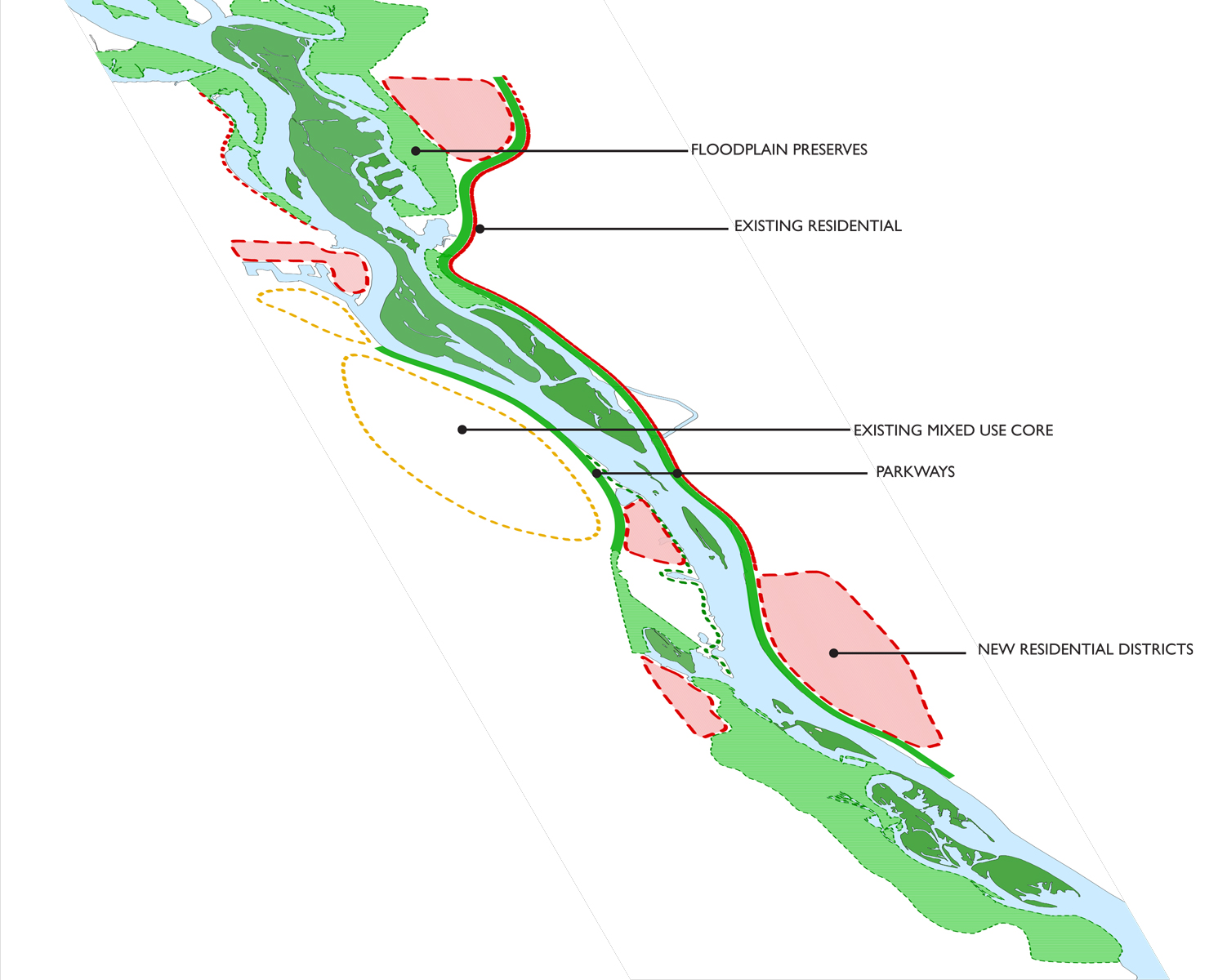
The edges of the park are vital to its success. Existing floodplain areas adjacent to the park should be maintained as nature preserves. Roadways along the right and left banks should be remade into medium-speed parkways or boulevards designed to enhance the experience of the river’s edge. To accommodate population growth, new residential mixed-use districts should be developed in former industrial areas and in the currently low-density suburbs along the river banks.
LINKS
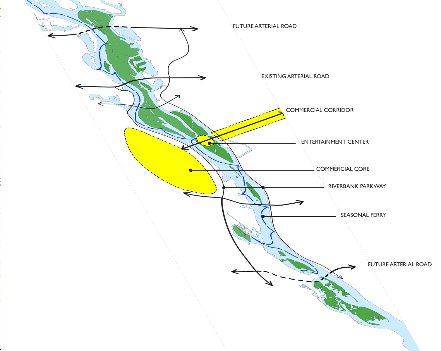
East-west and north-south links are developed as a way to knit the park and the city together. A central east-west axis is reinforced by the buildup of the existing commercial corridor along Brovarsky Avenue, extended to the newly developed entertainment zone on Venetsyansky Island, and linked to the existing commercial core on the right bank. Arterial roads and metro lines connect the islands to both banks. Seasonal ferry service provides a north-south link to the center of the city.
HYDROLOGY
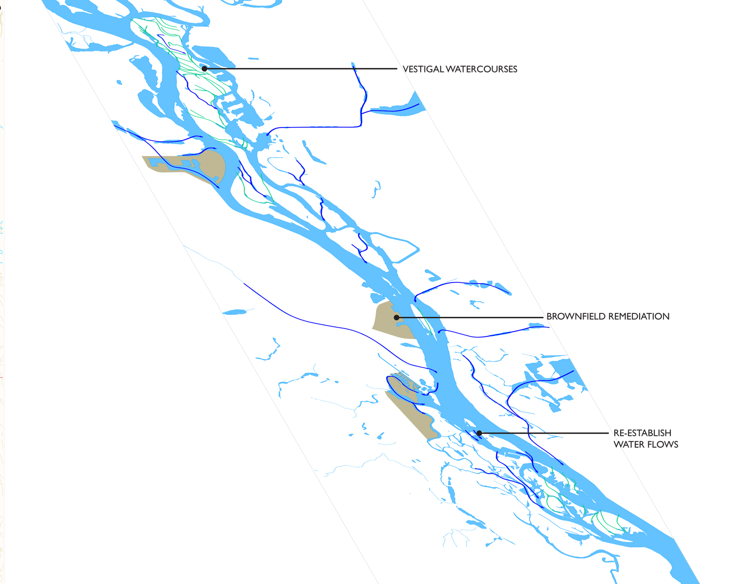
Configuration of the Dnieper islands used to change with each spring flood, but in recent decades control of water flows has, for most part, stabilized the shorelines. This made habitation more predictable, but the hydrology of the river has been compromised by dam construction, poor maintenance, and industrial activity. We propose introducing new tunnels to eliminate dead-ends and restore the former water flows. Flood plains will be designated as no-build areas and maintained as nature preserves. Remediation of existing brownfields will improve water quality and allow for new, less toxic development along the river.
THE ISLANDS
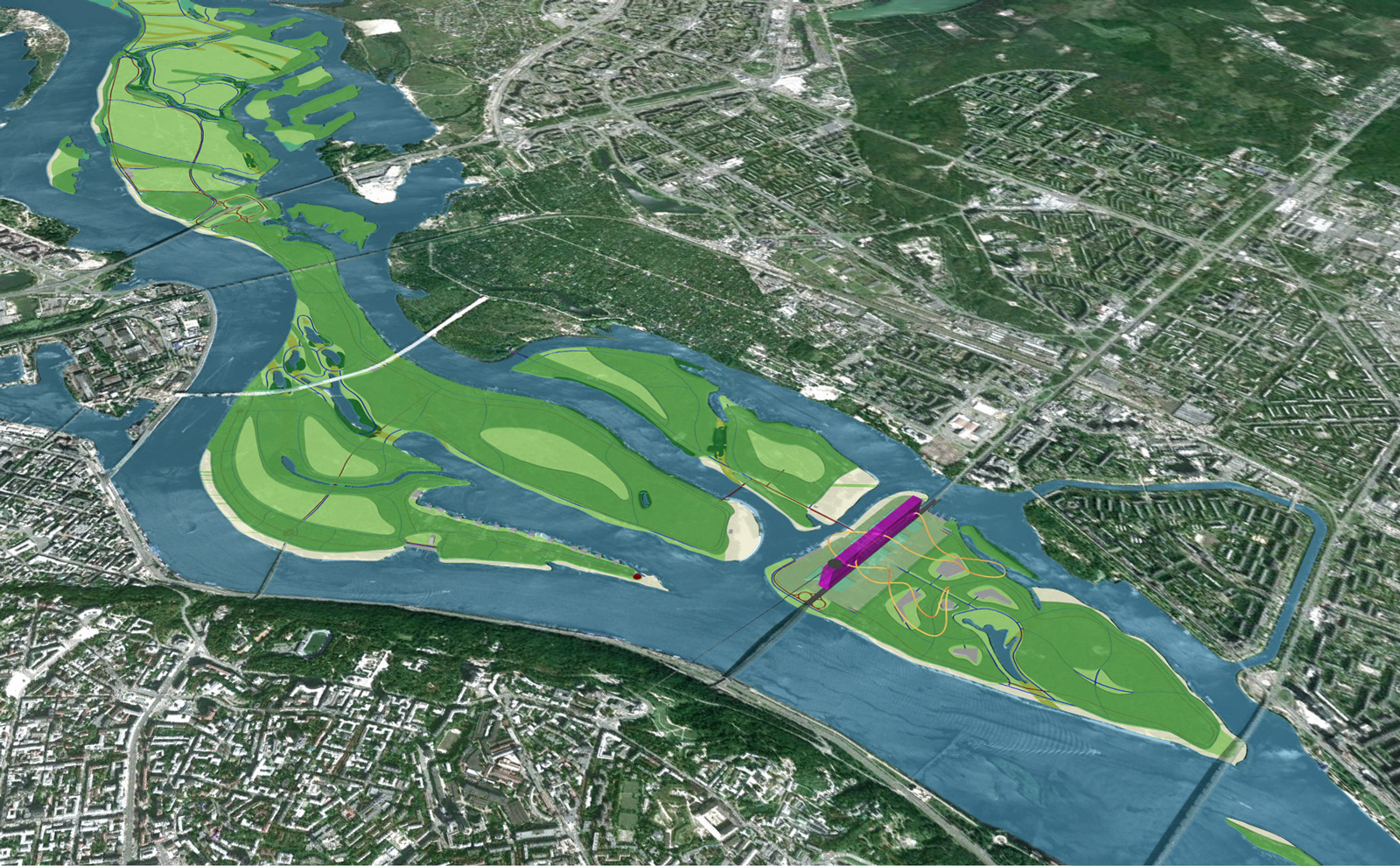
Truhaniv, Dolobetsky, and Venetsyantsky Islands are the focus of a more detailed development in the project. These islands are currently closest to the urban core of the city, and the right balance must be struck between the need for more intensive uses and the tranquil, natural space.
A key element is the reinforcement of the historic east-west axis in Venetsyantsky Island between these two sides of the city, which will knit the city together into more of a single entity. This area will become a new center of the city, dedicated to recreation and entertainment, uses that are harmonious with the rest of the park.
NODES
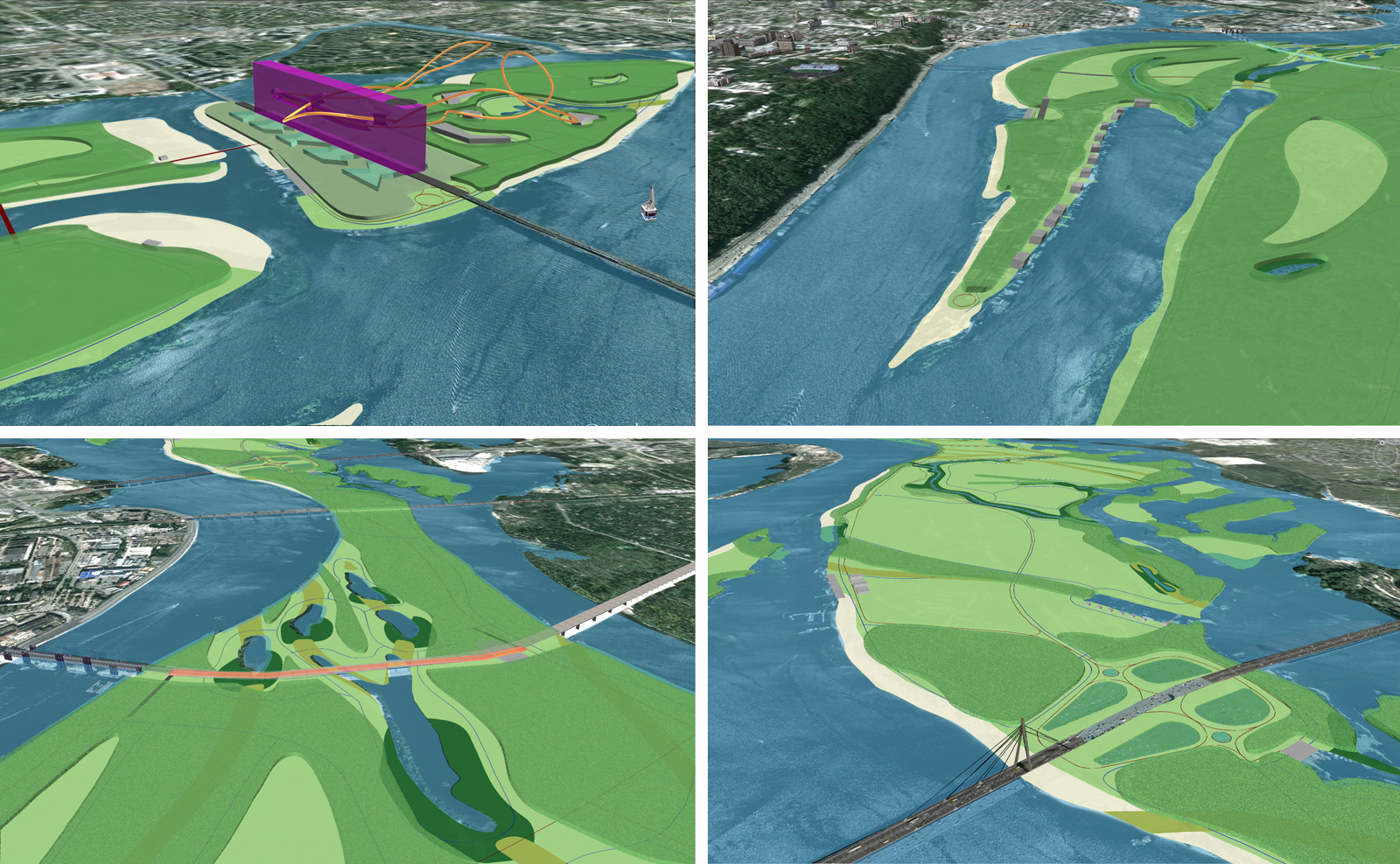
Entertainment Center - an urban park with a fun palace, an amusement park, a hotel, clubs, and restaurants. Easily accessible by car, metro or cable car, it will become the locus of pleasure in the middle of the city. The slab-like “scaffold” relates to the beaches on the southern ends of Truhaniv and Dolobetsky Islands, connecting these areas together and providing a setting for spectacles.
Matvivska Sports Clubs - public/private clubs, located along the edge of the Matvivska Gulf, will be used as seasonal camps and as a base for water sports. Rowing and speed-skating courses will be located in the gulf. The eastern edge of the gulf will be graded with a gentle slope for picnicking and event viewing.
Eco-Science Center – the location takes advantage of the planned metro stop at the Podilsko-Voskresensky Bridge. The Center structure will hover over the unique landscape below and will provide an east-west pedestrian link on the island. The plan includes nature trails and an interactive learning center.
Moskow Bridge - provides a direct link to new developments in the northern part of the city. Parking lots, accessed directly from the bridge, limit impact on the island and serve as an intermodal node in the transportation network of ferries and shuttle buses. The more intensive uses are located in immediate proximity to the bridge, while a preserve extends to the north.
ECOLOGICAL ZONES
The natural ecology of the islands will be preserved, enhanced, and clarified. Each eco-zone is redefined through restoration and nurturing of its native species. The boundaries between the zones are the fulcrum of the metamorphic character of this natural river space, and they are to be carefully tended in order to promote continual and organic transformation of the islands.
CIRCULATION
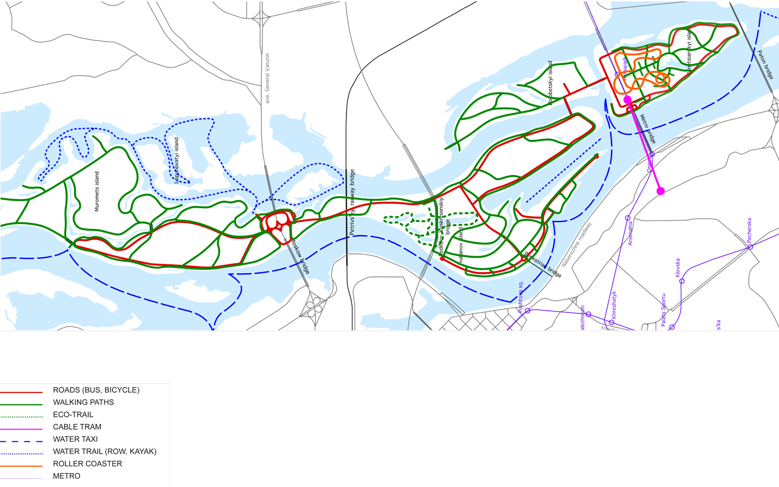
New bridges link Truhanov, Dolobetsky and Venetsyantsky Islands. Automobile use on the islands is limited to service vehicles. Parking is located on Venetsyantsky Island and at the Moskow Bridge. A shuttle bus loop runs from Truhanov Island to Venetsyantsky Island. A new aerial tram creates a direct link between Pechersk and the Entertainment Center on Venetsyantsky Island.
ACTIVITY ZONES
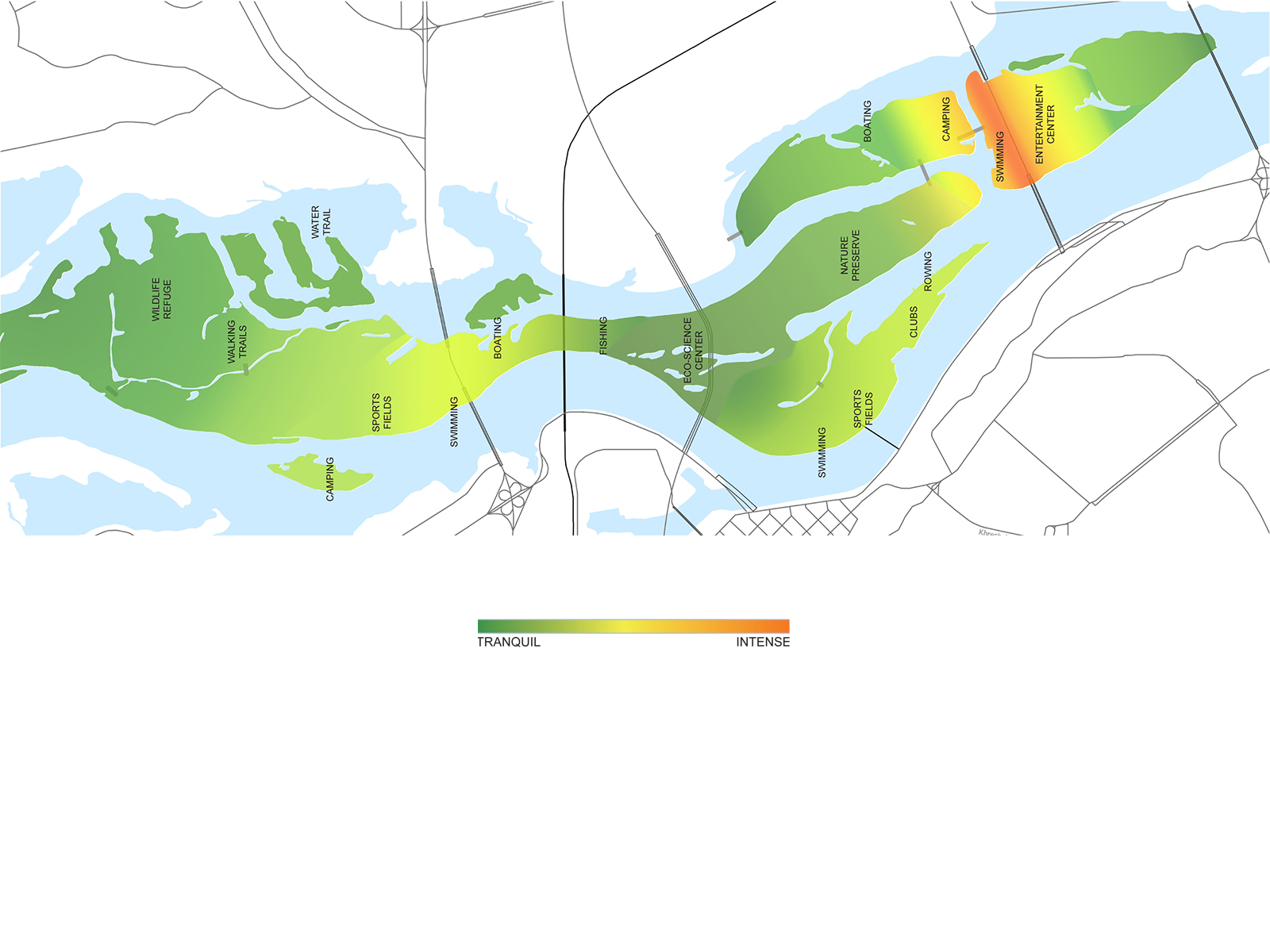
The park accommodates a variety of uses ranging from passive to active. The entertainment zone on Venetsyantsky Island is an urban park with a fun palace, an amusement park, a hotel, clubs, and restaurants – it is the most intensive-use zone in the park. Another relatively intensive-use area is located at the Moskow Bridge. The Matviivska Gulf is designated as an area of regulated recreation (rowing, sports clubs), while the northern Truhanov, Dolobetsky and southern Venetsyantsky Islands are preserves where only passive activities are permitted.
ECONOMICS
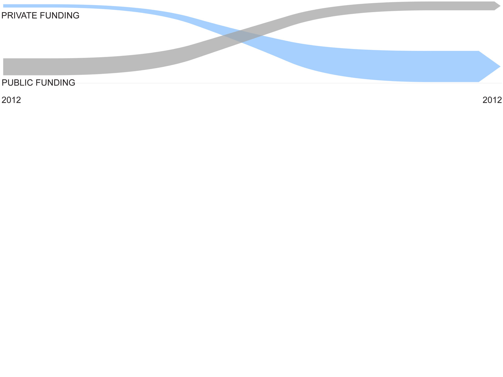
Creation of a Public/Private entity is proposed to finance the construction and subsequent maintenance of the park. Existing private owners will be compensated for ceding the ownership rights to the park authority. All private enterprises will have to lease their space, with a percentage of the rent going to park maintenance. The entertainment center on Venetsyantsky Island will provide substantial and stable financing for this purpose. The entire program is intended to be phased in over a ten-year period.
Kiev Islands Park
Kiev, Ukraine