The symbolic merits of placing the UN within the Harbor context of the Statue of Liberty and Ellis Island are obvious. There are also many practical arguments for such a move - the UN is acutely short of space, lacks a high tech infrastructure, and its growing security concerns are difficult to address in its dense neighborhood. Profits from redevelopment of the current UN buildings and sale of the land that is adjacent to very valuable real estate, would go a long way towards paying for the construction of new quarters. Lower Manhattan would also benefit - as UN-related functions gravitate there, they would help promote mixed-use development in the area.
Primary access to the Island would be by ferry to a new harbor on its western shore, with a heliport located on the eastern shore. Existing small boat harbor between the Island and Brooklyn Battery Tunnel air tower would remain open for public use. Services would be through a dock on the Buttermilk Channel; as tunneling technologies improve, access via the Tunnel will become achievable. Transportation on the Island would be limited to vehicles powered by electricity.
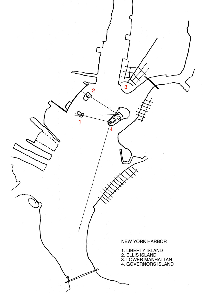
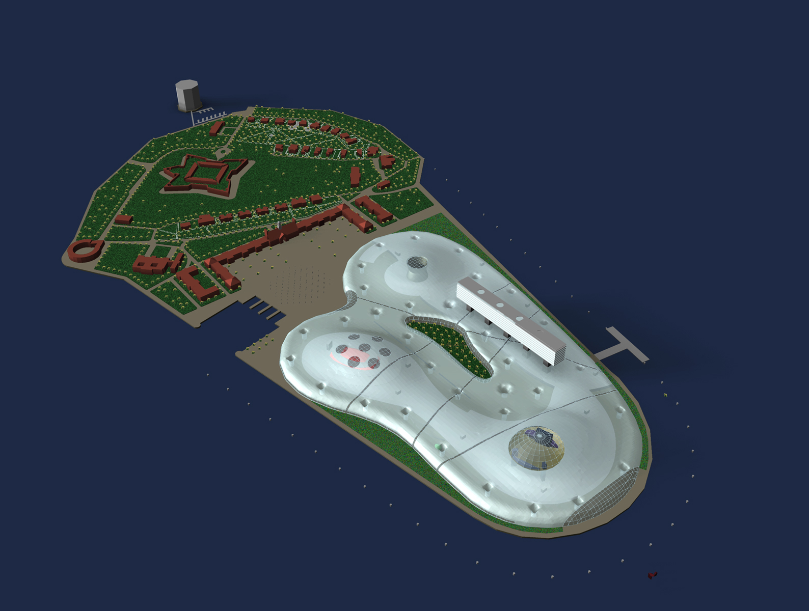
The Island, first sighted by Verrazano in 1524, served as a military defense position from 17th century through the 1960’s, and housed the nation’s largest Coast Guard base between 1966 and 1995. In the early 1900’s, it was more than doubled in size to its present 172 acres with fill from the subway excavation. The Island is thus naturally divisible into two parts - the original land mass at its north and the landfill to the south. The northern part, a designated National Historic District, is home to mature trees and many buildings of merit, including six individual NYC landmarks. The southern part, although an exceptional site, is poorly planned and full of banal buildings; this is the area that we proposed for the UN.
The nearly 93-acre Historic District to the north would be developed as a public park with the six designated NYC landmark structures open to the public. The remaining buildings on the north side of Division Street would house an Institute of International Studies affiliated with a NY academic institution. The vast Liggett Hall Barracks would house offices and act as the symbolic core of the Institute. The historic homes and Colonel’s Row houses would become housing for visiting scholars.
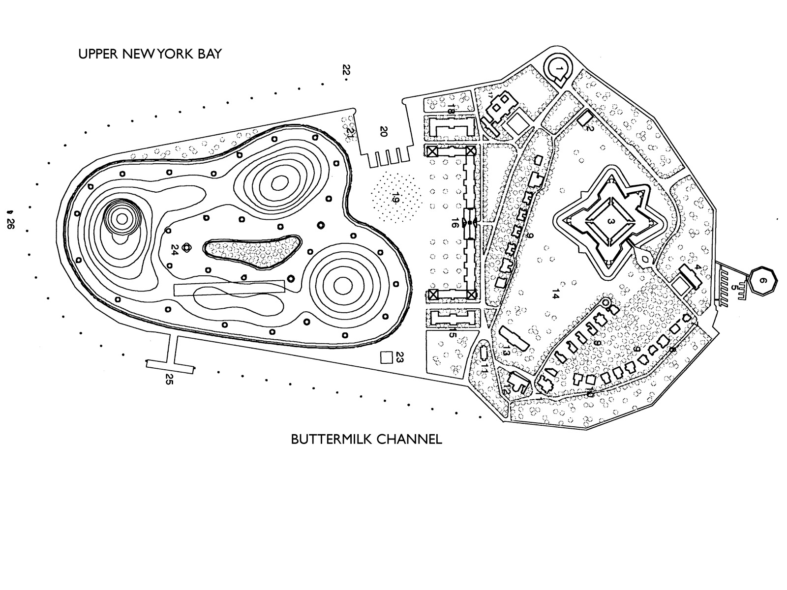
A harborside plaza filled with emblems of the Nations would offer unobstructed views of the Harbor landmarks and create a common ground between the Institute and the UN. Building 550 next to the harbor would become a hotel for short-term visitors
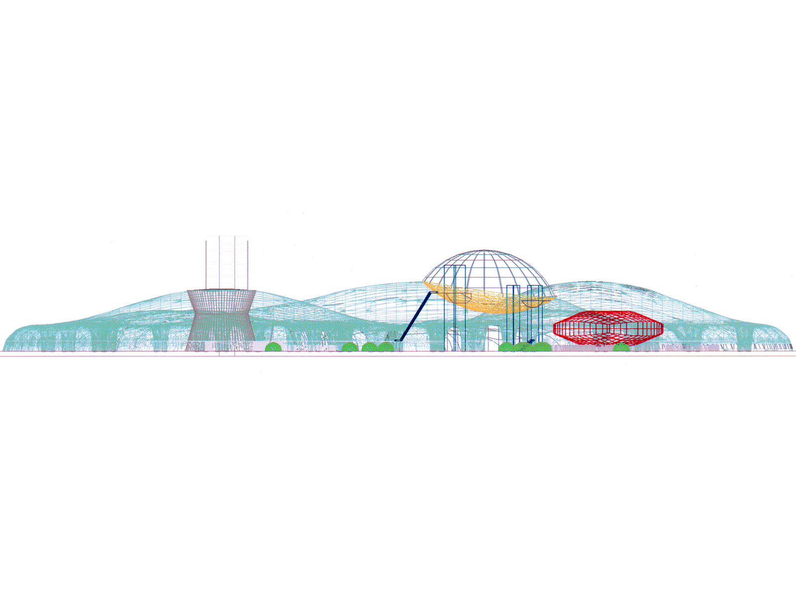
The United Nations complex is conceived as a "big tent" spread over the 82 acres of the southern part of the Island (existing buildings on this side, all of no historical or architectural significance, would be demolished). A "barrier reef" around this part of the island would form a natural defensive perimeter.
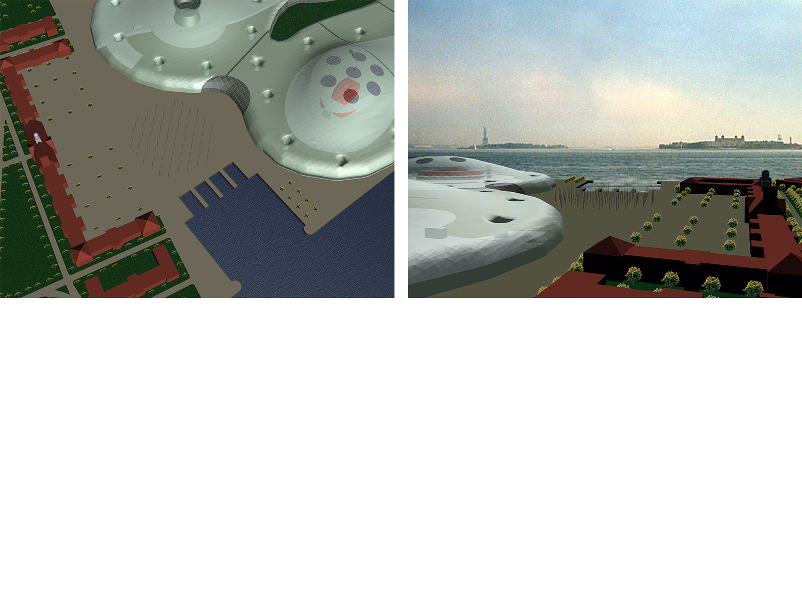
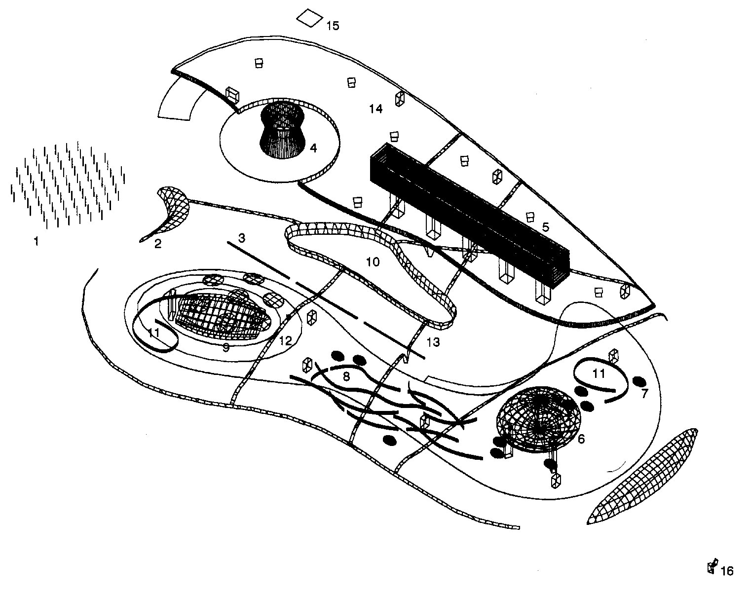
The UN building is conceived as a big tent, with public functions at the ground level and diplomatic functions above. The main entrance is from the plaza, through a security vestibule, with an information center and a cafe adjacent to the entry. Moving walkways running the length of the building terminate at the southern end in a clear "bubble" with views of the Harbor and Verrazano Bridge. Moveable walls at the ground level accommodate temporary functions and "meeting pods" for various interest groups and diplomats. Two large ramps provide access from the lower to the second level. A seasonal garden puncturing the center of the tent loosely establishes two paths within the complex - one for the public, the other for the diplomats.
The tent is a translucent pneumatically-tensed membrane with four bands symbolizing the four continents cut through its surface. Large internal-drainage tensile "columns" are spaced at intervals inside the tent to collect rainwater for filtration and re-use. Photo-voltaic cells are placed on the surface at optimal angles for accumulation of solar energy. Lit from within, the tent will glow at night, and images can be projected onto its surface.
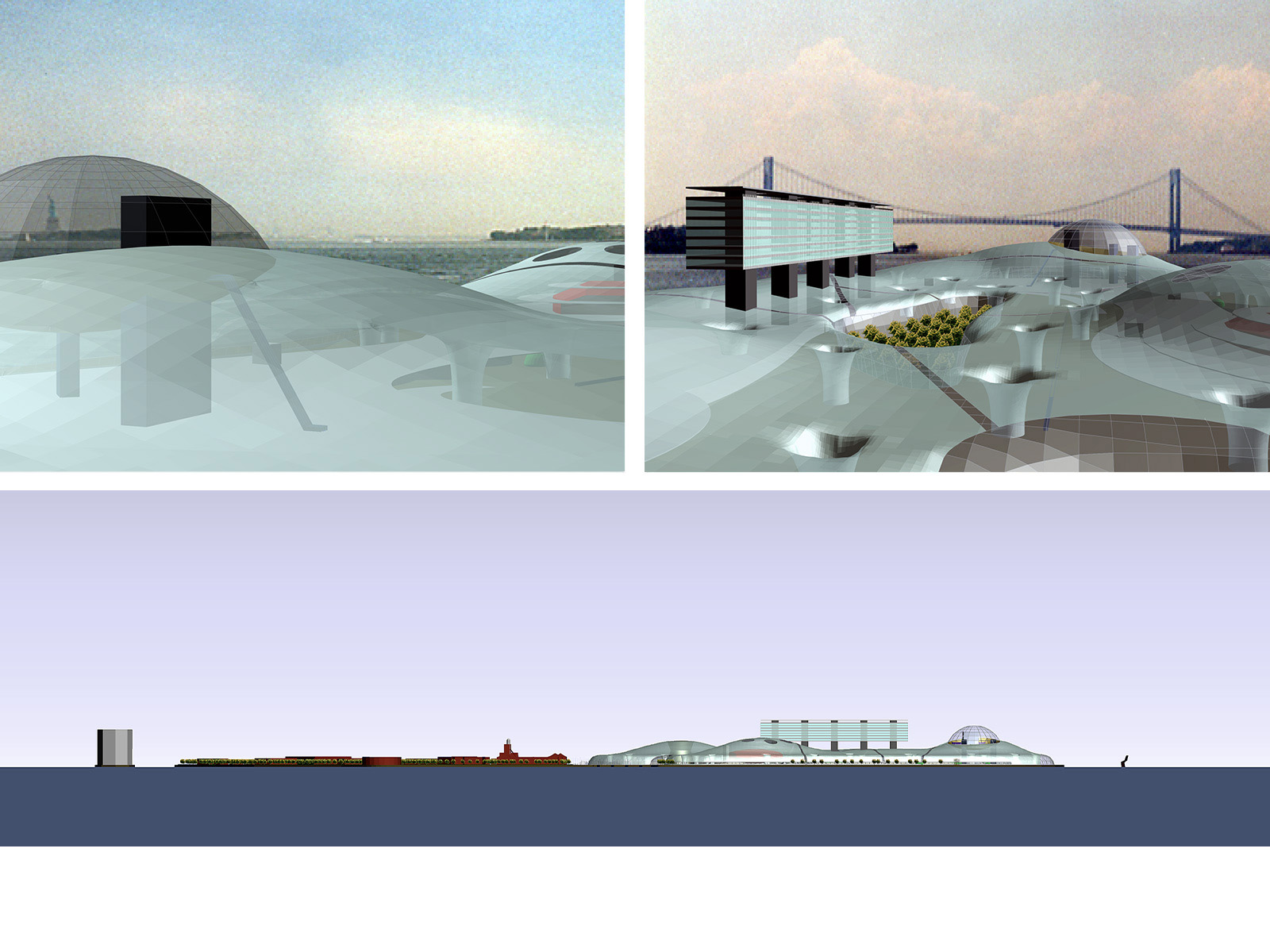
UN - Governors Island
New York Harbor